


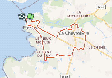
la chevroliére Passay variante chemin inondé

Fauvette 44
User

Length
9.2 km

Max alt
13 m

Uphill gradient
42 m
Km-Effort
9.8 km

Min alt
2 m

Downhill gradient
43 m
Boucle
Yes
Creation date :
2024-04-08 08:25:45.709
Updated on :
2024-05-16 09:39:02.765
2h13
Difficulty : Medium

FREE GPS app for hiking
 SityTrail
IGN / Geographical institutes
SityTrail Plus
The world is yours!
About
Trail Walking of 9.2 km to be discovered at Pays de la Loire, Loire-Atlantique, La Chevrolière. This trail is proposed by Fauvette 44.
Positioning
Country:
France
Region :
Pays de la Loire
Department/Province :
Loire-Atlantique
Municipality :
La Chevrolière
Location:
Unknown
Start:(Dec)
Start:(UTM)
603346 ; 5216871 (30T) N.
Comments